| Key to Kansas |
|
|
|
|
|
Overview
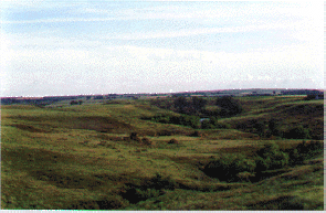
Geographic InformationKansas lies in a geographical transition area of the country. Land elevations rise gradually from east to west in Kansas. The eastern border of Kansas is approximately 800 feet above sea level, while the western border rises to 4000 feet above sea level. A physiographic map identifies the various regions in Kansas. The eastern part of the state is part of the Osage Cuestas with hills covered by areas of forest. The northeastern corner of Kansas has outcroppings of rocks from areas north of Kansas that were left behind by glaciers that extended into Kansas during some of the earth's ice ages. The southeastern tip of the state is part of the Ozark Plateau.
The south central part of Kansas includes the the Arkansas River and Wellington-McPherson Lowlands and the Red Hills . The western part of the state, known as the High Plains, is flatter and drier than eastern or central Kansas, with few trees and shorter grasses. The southwestern part of the state includes canyons and sand dunes similar to the land of New Mexico. The changing seasonal climate and the availability of water resources have been major factors in the history of Kansas. Harsh winters, hot summers and the lack of rainfall in the central and western part of the state frequently made life difficult for the early settlers of Kansas. Rainfall in the east averages 34 to 40 inches annually. Annual rainfall in the west of Kansas is only 16 to 20 inches. Finding adequate sources of water has always been an important part of life in Kansas. Aquifers lie under the ground in much of Kansas. These include the Glacial Drift aquifer in the northeastern part, the Ozark aquifer in the southeastern part and the High Plains aquifer , which lies under much of the western half of the state. The rivers flowing through the state played major roles in the exploration and settlement of Kansas. The Republican and Smoky Hill rivers flow through the west central part Kansas and join to form the Kansas (or Kaw) River near Junction City. The Kansas River eventually joins the Missouri River, which flows along the northeastern border of the state, at Kansas City. The Arkansas River flows from Colorado across the southern half of the state. Rights to the water of the Arkansas River have been a source of conflict for many years between Kansas and Colorado. The Cimarron River in the southwest and the Verdigris and Neosho rivers in the southeast are tributaries of the Arkansas River.
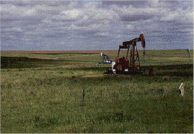
Mining in the southeastern part of the state for coal, lead and zinc was also a major industry in Kansas during the early part of the 20th Century. Other minerals which are mined in Kansas are salt, limestone and helium.
Additional Resources
Study Guide Questions:
|
|
|