| Key to Oklahoma |
|
|
|
|
|
Overview
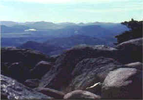
GeographyCalled the Sooner State, Oklahoma lies in the South Central United States. Adjacent states include Texas, New Mexico, Colorado, Kansas, Missouri and Arkansas. Oklahoma ranks eighteenth in size among all the states. It has a total area of 69,956 square miles. The state’s landscape varies greatly. Topographically, the state slopes from northwest to southeast and includes seven natural regions. They include the West Gulf Coast Plain and the Red River Valley, the Ouachita Mountains, the Arkansas River Valley and the Ozark Plateaus in the southern and eastern parts of Oklahoma. The Great Plains occupy most of western Oklahoma while the Osage Plains dominate central Oklahoma. About three-fourths of Oklahoma falls within the Osage Plains, which is part of the Central Lowlands.
Oklahoma is in the temperate zone. That means the state’s climate is relatively mild. The average temperature in January is 39 degrees Fahrenheit. In July, the average is 83 degrees Fahrenheit. Annual average rainfall declines from east to west across the state. Rainfall ranges from sixty inches per year in the eastern part of Oklahoma to ten inches per year in the western section of the Panhandle. The Sooner State lies in the western Mississippi River Valley. That means its rivers flow from the northwest to the southeast. The Red River forms Oklahoma’s southern border. It flows on through Louisiana before it joins the Mississippi River. Some of the Red River’s tributaries include the Washita in the western part of the state and the Kiamichi in the east. The Arkansas River cuts through northeastern Oklahoma. It flows through Arkansas before joining the Mississippi. Tributaries of the Arkansas flare out across the entire state. Some of its tributaries are the Canadian, the North Canadian, the Cimarron, the Verdigris and the Grand. Oklahoma is rich in natural resources, including mineral deposits. It has enormous quantities of petroleum, natural gas, lead, coal, asphalt, gypsum, salt, sand, stone, zinc, clay and helium. The state also has important deposits of phosphate, volcanic ash, radium and tripoli. Forests cover about one-sixth of Oklahoma. Eastern Oklahoma has both pine and hardwood forests. Varieties of trees include oak, elm, hickory, pecan, ash, walnut, magnolia and even cypress. The lumber industry is important to the eastern part of the state. Water is one of the most abundant resources of the state, and it plays a valuable role in the success of both farming and ranching. During the New Deal of the 1930s, the federal government helped the state develop its water resources by constructing Grand River Dam. During the 1940s and, particularly, during the governorship of Robert S. Kerr from 1942 to 1946, engineers constructed more dams and reservoirs. Such work continued into the 1950s and 1960s. The Kerr-McClellan Navigation System was dedicated in 1971.Through a combination of dams, locks and channels, it provided a transportation system for barges from Tulsa to the Mississippi River. Sometimes called "America’s Frontier Lake State," Oklahoma has more than one hundred natural lakes. It also has more than two hundred man-made lakes. Examples of lush vacation spots for fishing, boating and nature lovers are Lake Texoma, Lake Eufaula and Fort Gibson Lake. Lake Eufaula is the largest lake in the state and one of the largest artificial lakes in the world. The state has thirty-two state parks and three national parks. Although we do not usually think of Oklahoma as the scene of severe weather, the state has had its share of tornadoes, thunderstorms, droughts, earthquakes and the like.
Additional Resources
Study Guide Questions:
|
|
|